MicroStation: CAD Software for Engineers.
MicroStation is a professional CAD software for 2D drafting and 3D modeling, widely used for infrastructure design, modelling, and BIM workflows.

CAD Software Price
Buy MicroStation
1 Year
3 Year
Projects
What’s included
About this software subscription
This Virtuoso Subscription includes a 12-month practitioner license for this software that comes with Keys (credits) to unlock training and services.
CAD Software Features
Key Features
2D Drafting Tools
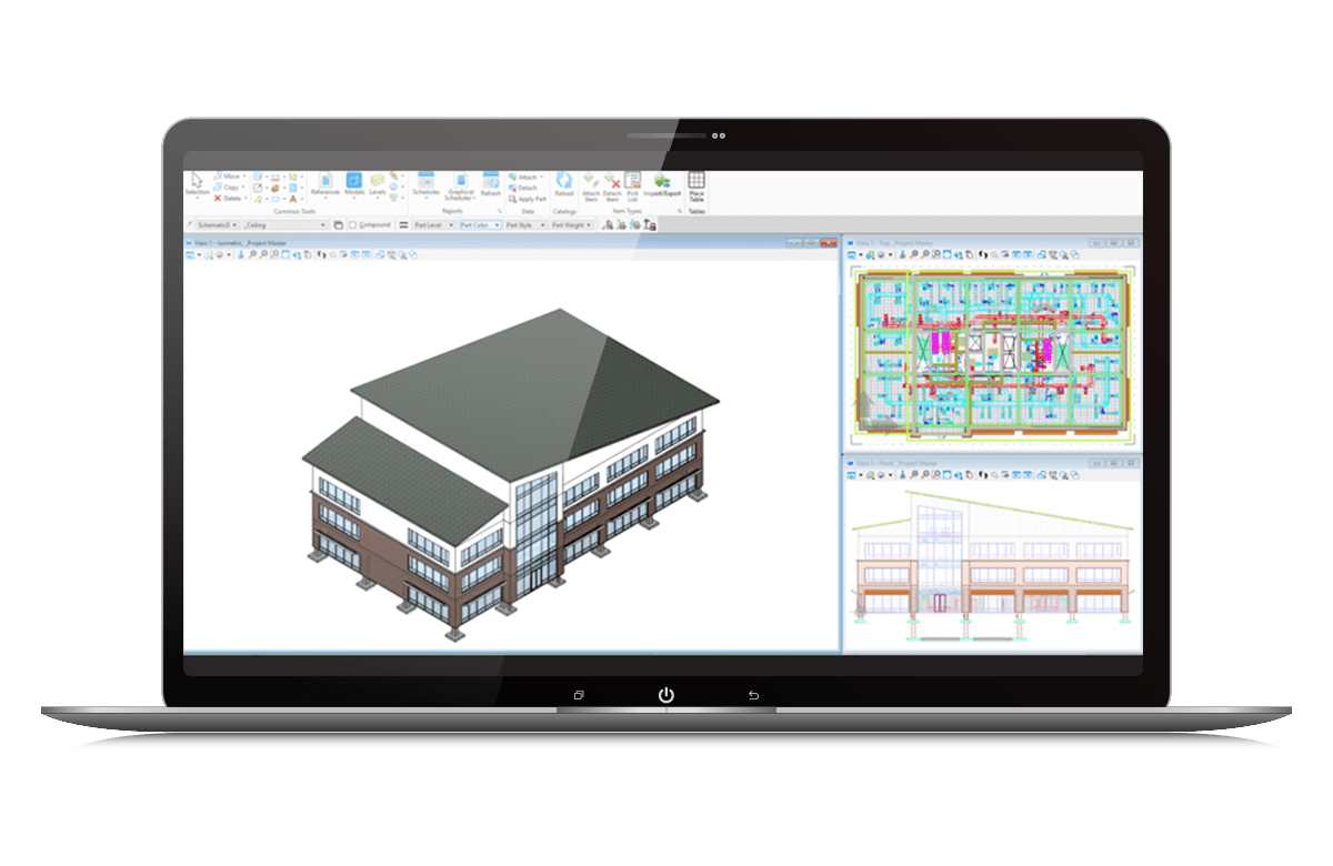
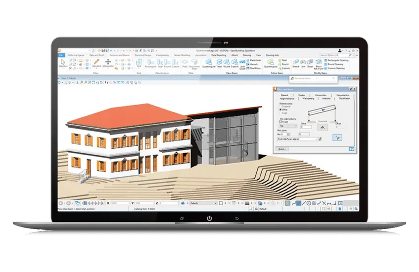
MicroStation excels in 2D and 3D precision drawing with tools for detailed drafting and annotations. Its AccuDraw and AccuSnap features enable highly accurate positioning of objects, while providing advanced dimensioning and snapping capabilities, allowing users to create designs with exact measurements.
3D Modeling and Visualization
Develop models in real context with a wide range of 3D modeling tools. Build and edit curve, surface, mesh, feature, and solids models. Build functional and parametric components with predefined variations to simplify managing and finding many similar components.
Interoperability
MicroStation supports a wide range of file formats including DWG, DXF, DGN (native format), IFC, STEP, IGES, STL, and many others. It is also known for its excellent interoperability, allowing smooth integration with BIM, GIS, and other point cloud and photogrammetry software.
Technical Capabilities
Develop detailed design & construction documents with MicroStation.
Advanced 2D and 3D Design Tools
Extensive mesh, solid, surface, and feature modeling tools for intricate designs.
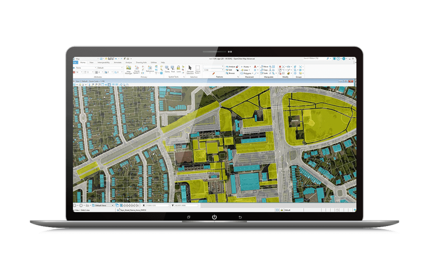
Geospatial Integration
Incorporate real-world geospatial data from thousands of coordinate systems.
Parametric Design
Automate drawing sheets, models, visualizations, and documentation with parametric components.
File Interoperability
Work with a wide range of file formats including DWG, DXF, DGN, IFC, STEP.
Design Review
Leverage iTwin Design review to keep track of and resolve issues in the CAD files.
Advanced Visualization and Analysis
Create hypermodels, lifelike renderings, and animations to enhance design communication.
Additional Features
CAD Compability
Easily read, share, and consume precise data in key industry formats such as Autodesk®’s RealDWG™ (share and consume), IFC (read), Esri SHP (read), and more. Aggregate and assemble multiple file formats including PDF, U3D, 3DS, Rhino 3DM, IGES, Parasolid, ACIS SAT, CGM, STEP AP203/AP214, STL, OBJ, VRMLWorld, SketchUp SKP, and Collada.
Model in 3D
Develop models in real context with a wide range of 3D modeling tools. Build and edit curve, surface, mesh, feature, and solids models. Build functional and parametric components with predefined variations to simplify managing and finding many similar components.
Develop 2D Documentation
Develop precise drawings using a comprehensive set of drafting tools to efficiently create 2D geometry. Rapidly progress your designs from concept to completion using persistent constraints to maintain your design intent.
Model Visualization & Analysis
Communicate your design intent with MicroStation’s visualization capabilities and increase the buy-in for your project across all stakeholders. MicroStation can analyze and visualize models based on their geometry or attributes. You can detect and resolve clashes, as well as analyze real-world solar exposure and shading. Real-time display styles can be applied to visualize models based on each object’s height, slope, aspect angle, and other embedded properties.
Component Management
MicroStation allows you to create and use smart parametric objects with pre-defined variants so that you can have fewer objects in your library to search through and manage. They also include the 3D and various 2D representations of those objects and can be managed and shared via cloud services with project teams along with any associated documents, such as specifications.
System Requirements
Minimum Operating System Specification
MicroStation delivers multiple products to users that will have different system requirements. Each software’s minimal requirements are located on the software’s product page. Below is the list of system requirements for MicroStation.
Processor
Intel® or AMD® processor 2.0 GHz or greater
Memory
1 GB minimum, 2 GB recommended, (more memory typically results in better performance)
Disk Space
1.25 GB minimum free disk space
Operating System
Windows 10 (64-bit) - Home, Pro, Enterprise, and Education
Windows 8 (64-bit) - Standard, Pro, and Enterprise
Windows 8.1 (64-bit) - Standard, Pro, and Enterprise
Windows 7 SP1 (64-bit) - Home Basic, Home Premium, - Professional, Enterprise, and Ultimate
Windows Server 2008 R2 SP1 (64 bit) - Standard and - Enterprise
Windows Server 2012 (64 bit)
Professional Services
BIM Support Services
Need help implementing BIM in your project? Leverage Bimeco's professional services, advanced technology infrastructure, and tested workflows on your next project.
Our Packages